
Mint Hill Previous Residents Sources
The best starting point for previous residents is the current parcel, not a surname. Mint Hill can reach Mecklenburg or Union County, and the county determines the deed, tax, and court route. For a Mecklenburg address, preserve the parcel ID, county, situs, map date, legal description, and current deed reference. Then move backward through recorded conveyances and only afterward layer in sources that may show a household. The eras below show what the source can establish.
| Source | Years | Where | What It Shows |
|---|---|---|---|
| Modern Register of Deeds | March 1990 to present | Mecklenburg Register of Deeds | Recorded instruments, parties, dates, book or page, and legal descriptions |
| Historical Land Records | 1763 to February 1990 | Mecklenburg Historical Land Records | Historic grantor or grantee index paths and deed images where available |
| Directories and library files | Identified dated volumes and collections | Carolina Room, DigitalNC, Olde Meck | Address, household, business, map, and newspaper clues with coverage limits |
| Federal census | 1790 to 1950 public schedules | National Archives and library research routes | Dated household and enumeration information, not a current address list |
| Permits and planning files | Current records and case-specific documents | Mecklenburg Code Enforcement and Mint Hill Planning | Construction, project, PID, deed, and development context |
Start with the modern deed route for a recent sale. If the search crosses the 1990 boundary, switch to the historical index rather than treating a modern no-result as the end of the chain. For an older Mint Hill house, the address itself may not stay stable. The legal description, plat, tract language, and book or page are the bridge across older street forms and parcel changes.
Mint Hill Deed Chain Start
Use the current parcel to begin the backward trail. POLARIS 3G accepts an address, parcel number, owner, or landmark and can expose the parcel boundary, situs and mailing fields, owner category, deed reference, and map tools. Keep the search date because GIS and tax layers are administrative records that may lag an instrument recorded with the Register of Deeds. A tax owner can be a corporation, estate, trust, government body, or mailing recipient, and no mailing field proves who lived at the property.
For a Mint Hill address in Mecklenburg, continue to the Tax Administration and the deed reference, then locate the instrument in the Mecklenburg Register of Deeds index. Record the current parcel identifier and legal description before adding names to a timeline. A current address search can also begin on the Mint Hill by-street page, which explains how to preserve the supplied address and resolve its county before following the historic chain.
Note: A new subdivision, annexation, or deed recording can change a parcel label without proving that an occupant changed.
Mint Hill Historical Index Search
Mecklenburg's historical service spans 1763 through February 1990. In the historical search, select Type Land, then use the Grantor or Grantee subtype, the relevant year range, and the Human or Corporation path. Search a surname portion rather than assuming one exact spelling will capture every entry. A developer, trustee, estate, church, municipality, or limited liability company can appear under a different name form or index path.
Inspect the complete index page when older records place several names on one page. A chain can require the same person to be searched as a grantee in one transaction and a grantor in the next. Do not stop at the first name that looks familiar. Capture the instrument type, recording date, parties and their roles, book or page, image availability, and any legal-description wording. This makes a Mint Hill previous-residents search repeatable when another document changes the story.
Olde Meck's research resources collect deed-navigation, directory, probate, catalog, and research tips that help interpret a Mecklenburg address trail.
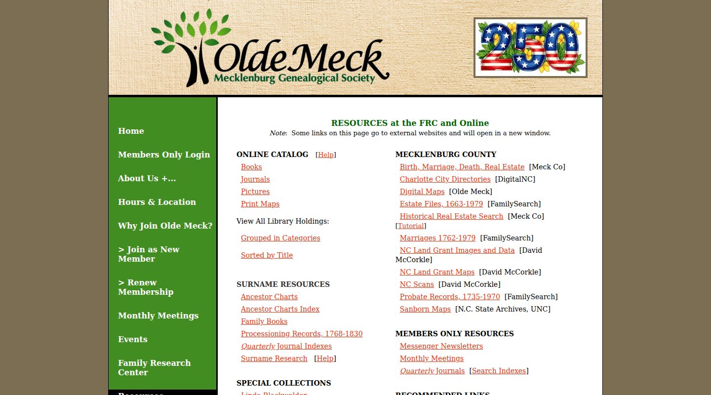
Use this research shelf to support a documented county-record trail, not to replace a deed image or current parcel check.
Mint Hill Legal Description
The legal description is the best continuity test when a Mint Hill street name, house number, or parcel boundary has changed. Compare the tract, lot, block, subdivision, map book, or plat reference in the recorded instrument with the current parcel. A street search is a useful discovery tool, but the legal description and plat do the harder work of connecting an older deed to a current location. GeoPortal itself warns that its general-reference map is not a legal survey, so consult the recorded deed and plat for that question.
- Grantor
- The party who transfers or releases an interest in an instrument.
- Grantee
- The party who receives the interest conveyed by the instrument.
- Chain of title
- The dated sequence of recorded instruments used to trace interests in a parcel backward.
- Legal description
- The recorded lot, block, subdivision, tract, or metes-and-bounds language that links a deed to land more reliably than a changing street label.
A trustee or lender named in a deed of trust is not necessarily the fee owner. A satisfaction or release ends a lien trail, while a plat defines lots, roads, and boundaries but is not a sale. Keep these document roles separate in a Mint Hill house-history timeline.
Trace Mint Hill Prior Owners
Each step should move from one documented transfer to the prior one. The sequence below is for tracing property interests, not declaring who occupied the home on any date.
- Search the current parcel and tax record, then save the parcel identifier, situs, county, current owner category, deed reference, legal description, and as-of date.
- Open the current owner's purchase deed in the modern Register of Deeds index and record the grantor, grantee, instrument type, recording date, book or page, and legal description.
- Search the seller from that deed as a grantee to locate the seller's earlier purchase. Compare the legal description before deciding it is the same parcel.
- Repeat the process backward, preserving releases, corrective deeds, easements, estate deeds, plats, powers of attorney, and foreclosure documents as separate events.
- When the date reaches February 1990, continue through the historical Land, Grantor or Grantee index and use both Human and Corporation paths as needed.
- Use permits or a Mint Hill planning packet after the deed chain is set. They may add construction or project context, but a planning file is a dated snapshot and not proof of a current owner or resident.
A Mint Hill site plan can list a PID and deed reference, and a Mecklenburg permit search can add issue, status, inspection, or certificate context. Those records help date the built environment. An applicant, contractor, property owner, and occupant can still be different people.
Mint Hill Past Household Trail
Ownership is only one layer of a previous-residents search. After the deed and address form are reconciled, compare dated household sources. The Carolina Room’s archives and special collections include Mint Hill among the Charlotte and Mecklenburg municipal holdings, with directories, maps, newspapers, yearbooks, vertical files, and local government material. The specific volume sequence and access notes are on the Mint Hill city directories page. A directory entry is a clue at publication time, not an exact census of every person at an address.
- Use the legal description, former street form, and county to choose a dated directory, map, newspaper, or library file.
- Record the publication year, page, address form, and the type of listing, such as household, business, office, or boarding location.
- Compare that clue with the census schedule closest to the period, noting the enumeration district and the schedule’s date.
- Use probate, deeds, newspapers, and local-history holdings to test relationships, moves, or estate connections, while preserving each source date.
Historical directories located for the area include 1887-8, 1889, 1908, 1932, and 1933. The 1887-8 volume mentions a new city-number system, which can explain a mismatch only after comparison with a street index and recorded legal description. Charlotte and immediate-suburb coverage does not prove that every rural Mint Hill household appears in a volume.
Mint Hill Census Gaps
Federal personal census schedules are publicly available through 1950 under the 72-year rule. For later decades, use the deed chain, dated directories, library collections, newspapers, permits, and local archives rather than assuming a newer personal schedule is public. The 1890 census is mostly absent because of the 1921 national Commerce Department fire. That is a federal census gap, not proof that Mint Hill or Mecklenburg courthouse records were lost in a fire.
Probate is another dated lead when a property trail reaches an estate. The North Carolina probate collection covers 1735 to 1970 and can include wills, inventories, receipts, accounts, administrations, bonds, petitions, guardianships, and settlements. A named heir, witness, executor, or guardian has a document role. It does not by itself establish that person lived at the Mint Hill address. No dedicated official Mint Hill obituary or cemetery index was located, so use newspaper, library, archive, and historical-society routes with the gap clearly noted.
Mint Hill House History Sources
When a deed chain reaches an unclear tract or older gap, shift to custodians and collections rather than filling the gap with assumptions. The Carolina Room offers virtual or appointment-based research and names Mint Hill in its municipal archive scope. Olde Meck provides deed and probate research guidance. The North Carolina State Archives has county finding aids and a Raleigh search room. The Mint Hill Historical Society and Carl J. McEwen Historic Village can provide local-history context or a referral, but neither is a public resident index.
Mecklenburg County formed from Anson County in 1763. That means very early work can require Anson-era or tract wording and State Archives guidance. Preserve a result such as “direct record,” “index lead,” “historical clue,” or “not located” in the timeline. A visible gap is more accurate than forcing a continuous list of Mint Hill past residents.
Mint Hill Previous Residents Limits
Use a record only for what it says. Current GIS may lag a recording. A tax owner or mailing address does not establish occupancy. A directory can list a business or previous address. A planning packet records a development case at a point in time, not a current resident. If the parcel is in Union County, repeat the property and deed route with Union County custodians instead of reading a Mecklenburg no-result as a negative answer.
Lawful house-history use. Research Mint Hill previous residents for family history, estate questions, property history, or personal curiosity. Do not use an address trail to locate, monitor, contact repeatedly, or harm a living person.