
Mint Hill Neighbors: Block Sources
Public sources describe land, administration, and a few project-specific relationships around a Mint Hill address. The strongest starting point is the parcel map, because it gives the PID or NC PIN needed to keep nearby lots separate. Mecklenburg tools may show an owner of record, a mailing address, a situs address, roads, districts, and parcel geometry. Recorded deeds and plats supply the legal chain behind the parcel. Permit and planning files add a dated project trail. None of those sources creates a complete list of people who live on a block.
| Block source | What it can establish | Access and limit |
|---|---|---|
| POLARIS 3G | Parcel geometry, owner and address fields, overlays, and a parcel identifier | Public viewer; record the map date and do not infer occupancy |
| Mecklenburg GeoPortal | Roads, services, districts, restrictions, parks, and other address layers | Public general-reference map, not a legal survey |
| Register of Deeds plat or deed | Lot, block, easement, party role, legal description, and title-document trail | Modern and historical index routes have separate coverage |
| Town planning record | Project parcel, road context, notice radius, and dated development information | Case-specific record, not a current household roster |
| Permit search | Project, inspection, and certificate sequence tied to an address | Online building records generally reach six years |
Start with the record that answers the narrow question. A parcel map is best for adjacent lots. A plat explains legal boundaries. A planning notice shows who received notice for one proposal. Each has a different date and purpose. Note: An owner field or mailing label is an administrative connection, not proof of a current resident.
Mint Hill Parcels Are Not Households
POLARIS and the Tax Parcel Ownership layer separate the situs from a mailing address and also retain owner, deed, sale, legal-description, municipality, and district fields. That separation matters around Mint Hill. A corporation, trust, estate, government unit, or out-of-area mailing recipient can appear in an owner field. A property may change hands before the tax or GIS view refreshes. A permit can name a contractor. A planning application can name a developer or consultant. Those entries are useful leads, but they should not be converted into a claim about who occupies a home.
- Parcel
- A mapped unit of land with an identifying number used by tax and GIS systems.
- Situs address
- The location assigned to the property itself, which can differ from the owner’s mailing address.
- PID or NC PIN
- A property identifier that helps keep similarly named streets and nearby lots from being mixed together.
- Plat
- A recorded map showing lots, roads, easements, or subdivision lines. It is not, by itself, a sale record.
Use the parcel identifier, rather than a surname, to join a map result to a deed book and page. That choice also limits errors when a street crosses a municipal or postal boundary.
Map Mint Hill Neighbors by Parcel
For an immediate block, preserve the supplied address before changing its format. Search the address in Mecklenburg GeoPortal, then open the same location in POLARIS 3G. GeoPortal accepts address or landmark text after at least four characters. POLARIS can search by address, parcel number, owner, or landmark and provides identify, layers, and property-analysis tools. The method below keeps nearby land records distinct from a conclusion about present occupants.
- Record the street number, name, suffix, postal city, and ZIP exactly as supplied. Capture the returned municipality and county separately.
- Identify the target parcel and save its PID or NC PIN with the map date. Review the situs and mailing fields as separate values.
- Use the identify tool on parcels touching or directly across from the target. Record parcel relations and public owner categories without building a personal roster.
- Open the deed or plat route only when a boundary, lot, or prior transfer needs checking. Compare the legal description with the parcel result.
- For a whole road rather than one block, use the fuller Mint Hill street directory record chain.
GeoPortal layers can also show districts, service information, parks, libraries, and restrictions. They give useful context for a block, but the county cautions that map information is general reference rather than a substitute for a survey or recorded legal description.
Mint Hill's 200-Foot Planning Notices
A distinctive public block trail appears in Town planning material. The official 2018 Planning Board packet includes an “Adjacent Property Owners within 200 feet” table with a PID, owner, address, and mailing fields for a particular planning case. That makes it a useful historical notice artifact: it documents which parcels were included in that proposal’s notice radius on that date. It does not establish a current block census, current ownership, or a list of Mint Hill neighbors.
The Town’s S23-6 site-plan material offers another local pattern, retaining a project address, a PID, a deed reference, roads, and landscape context. Read such files as planning snapshots. Follow the parcel identifier to current GIS and the deed route before treating an old project detail as current. This is especially useful when a new subdivision, a changed lot line, or a road name makes the map and older deed language look different.
Mint Hill HOA Records by Block
Neighborhood organization records serve a narrower purpose than county land records. Mint Hill HOA documents publish declarations, bylaws, budgets, covenants, and architectural-review material. They can help explain a tract name, a covenant, or why a recorded description uses particular language. The research did not locate a public member directory, so association existence, private documents, and individual membership must remain separate claims.
The Mint Hill Chamber is another community resource, but its membership concerns businesses and organizations rather than a resident roll. The Mint Hill Historical Society and the Carolina Room can add local-history context for a block. Those sources work best after the parcel and road are already resolved.
| Local resource | Useful block context | Important limit |
|---|---|---|
| Mint Hill HOA documents | Covenants, declarations, budgets, and architectural-review rules | Private organization materials; no public member roster located |
| Mint Hill Chamber | Community and business organization context | Membership does not establish residence |
| Mint Hill Historical Society | Historic village and local-history referral route | Not a searchable neighborhood directory |
A screenshot from the HOA governing-documents page shows the kinds of association materials available for a tract-level question.
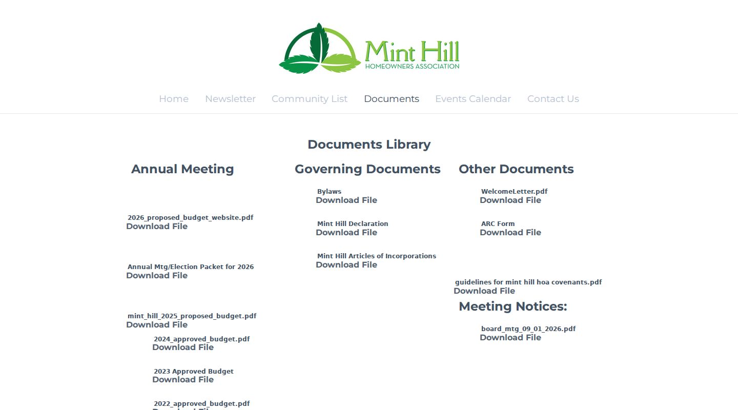
Those documents can clarify restrictions and review processes, while the recorded deed and parcel map remain the better sources for a boundary or ownership trail.
County Lines Affect Mint Hill Neighbors
Mint Hill spans southeastern Mecklenburg and northwestern Union counties. A town name or a 28227 postal label is therefore not enough to select a deed, tax, court, or voter route. The official NCDOR ZIP crosswalk even places 28227 under several city and county labels, including Charlotte/Mecklenburg, Charlotte/Union, and Mint Hill/Union. Confirm the county from the parcel or jurisdiction result before interpreting a nearby record.
This is not just a paperwork detail. A Mecklenburg “not found” result cannot settle a parcel that maps to Union County. Keep the postal city, municipality, fire or special district, county, and map date in the research notes. They can legitimately differ around a Mint Hill address.
Voter Records and Mint Hill Neighbors
North Carolina voter information is a separate registration record, not a block census. The NCSBE lookup uses a first name, optional middle initial, last name, birth year, county, voter status, and registered or removed/denied selections. Its results can route to jurisdiction, polling place, sample ballot, absentee information, and voter history. For a boundary address, test the county identified by GIS rather than assuming the town name controls the result.
Registration and history files have deliberate limits. NCSBE excludes full date of birth, Social Security, and driver-license information from voter-level files. Protected addresses, certain emails, and signatures also have restrictions, including protections under GS 163-82.10 and North Carolina’s Address Confidentiality Program. Treat an absent or protected result as a legal boundary, not an invitation to search around it.
Note: A voter record can document registration context at a point in time, but it does not prove current occupancy or consent to contact.
Official Records Versus Neighbor Tools
Commercial neighbor-finding tools can package names and addresses into a quick list, but their source dates, matching rules, and correction paths may be unclear. Official sources are slower because each one answers a smaller question. That separation is a strength when a Mint Hill block includes an estate, a trust, a business, or a parcel whose mailing address is elsewhere.
| Approach | Best use | Check before relying on it |
|---|---|---|
| Official parcel, deed, and planning sources | Lot relation, ownership role, legal description, and dated project record | Source date, county, PID, and whether the record concerns land rather than occupancy |
| Commercial neighbor tools | Possible lead for a name or address to verify elsewhere | Matching accuracy, source date, lawful use, and a direct custodian record |
Use an official custodian when a detail matters. Mecklenburg’s Tax Administration, GIS tools, Register of Deeds, and Town planning files give a traceable route. A compact list with no source date does not.
Mint Hill Neighbor Maps Change
Parcel and tax layers are living administrative records. Mecklenburg’s parcel metadata distinguishes owner, mailing, situs, deed, sale, legal-description, and district fields, and warns that the land record view can lag a recording. A new deed may appear at the Register of Deeds before a GIS owner field changes. Subdivision work can create a new PID, and an annexation can change a district label without changing a household.
Preserve the map date, PID, source URL, and the role of every name. A short timeline with a planning date, deed recording date, and current map date is more useful than trying to force all records into one current answer.
Mint Hill Neighbor Lookup Limits
Public land and planning records do not reveal every person connected to an address. They may omit renters, household members, protected voters, private association members, utility users, and people shielded by a court order or the Address Confidentiality Program. North Carolina’s public-record rules allow inspection of existing records, but GS 132-6.2 does not require an agency to create a custom resident list or turn unrelated files into one.
When a result is unclear, retain the uncertainty. The right next step may be a recorded plat, a county custodian, or no further search at all.